The driver collected us at Entebbe International Airport and headed straight through Kampala. Within minutes, the capital swallowed us whole. Vehicles crossed the road from every direction — matatu minibuses, saloon cars, lorries loaded with timber, and an endless river of boda-boda motorcycles weaving between them all. Along the roadside, small stalls and shops pressed up against the tarmac, their corrugated-iron roofs catching the late afternoon sun. Vendors sold airtime cards, roasted maize, and stacked towers of jerry cans, all within arm’s reach of passing traffic.
During my visit in October 2024 — the first of six trips I would make to Uganda between 2024 and 2026 — this was my introduction to how the country moves. Nothing prepares you for the sensory overload of Kampala’s streets: the honking, the red laterite dust, the sheer density of people and machines occupying every available metre of road. Over nine days spread across those visits, I drove through Kampala multiple times, navigated the Masaka Highway during its rehabilitation, passed through small trading towns like Luwero, and watched boda-boda riders carry improbable cargo through the countryside. Every photograph on this page is one I took myself, GPS-tagged to the location where I stood.
If you are planning a safari to Murchison Falls, Bwindi, or Queen Elizabeth National Park, you will spend hours on Uganda’s roads. Understanding what those roads look like, how traffic flows, and what to expect between your airport arrival and your lodge check-in is practical knowledge that most travel guides skip entirely. This is the guide I wished someone had written before my first visit.
Arriving in Kampala — Traffic, Boda-Bodas, and First Impressions
Most visitors to Uganda land at Entebbe International Airport, which sits on a peninsula jutting into Lake Victoria, roughly 40 kilometres south of Kampala’s centre. The airport road into the capital is one of the better-maintained routes in the country — a divided highway with street lighting and a reasonable surface. It lulls you into a false sense of order. The moment your vehicle enters the greater Kampala area, the character of the road changes completely.
Driving through Kampala in May 2026, the scene was identical to what I had witnessed eighteen months earlier on my first visit: boda-boda riders in fluorescent yellow jackets swarming intersections, weaving between bumpers, mounting kerbs, and threading through gaps that seemed physically impossible. Bicycles loaded with green bananas rolled alongside fuel tankers. Pedestrians stepped off the roadside into moving traffic with a confidence born of daily practice. The red laterite roads in the outer suburbs turned every vehicle the same shade of ochre. No lane markings, no traffic signals at most junctions, no separation between motorised traffic and everyone else.
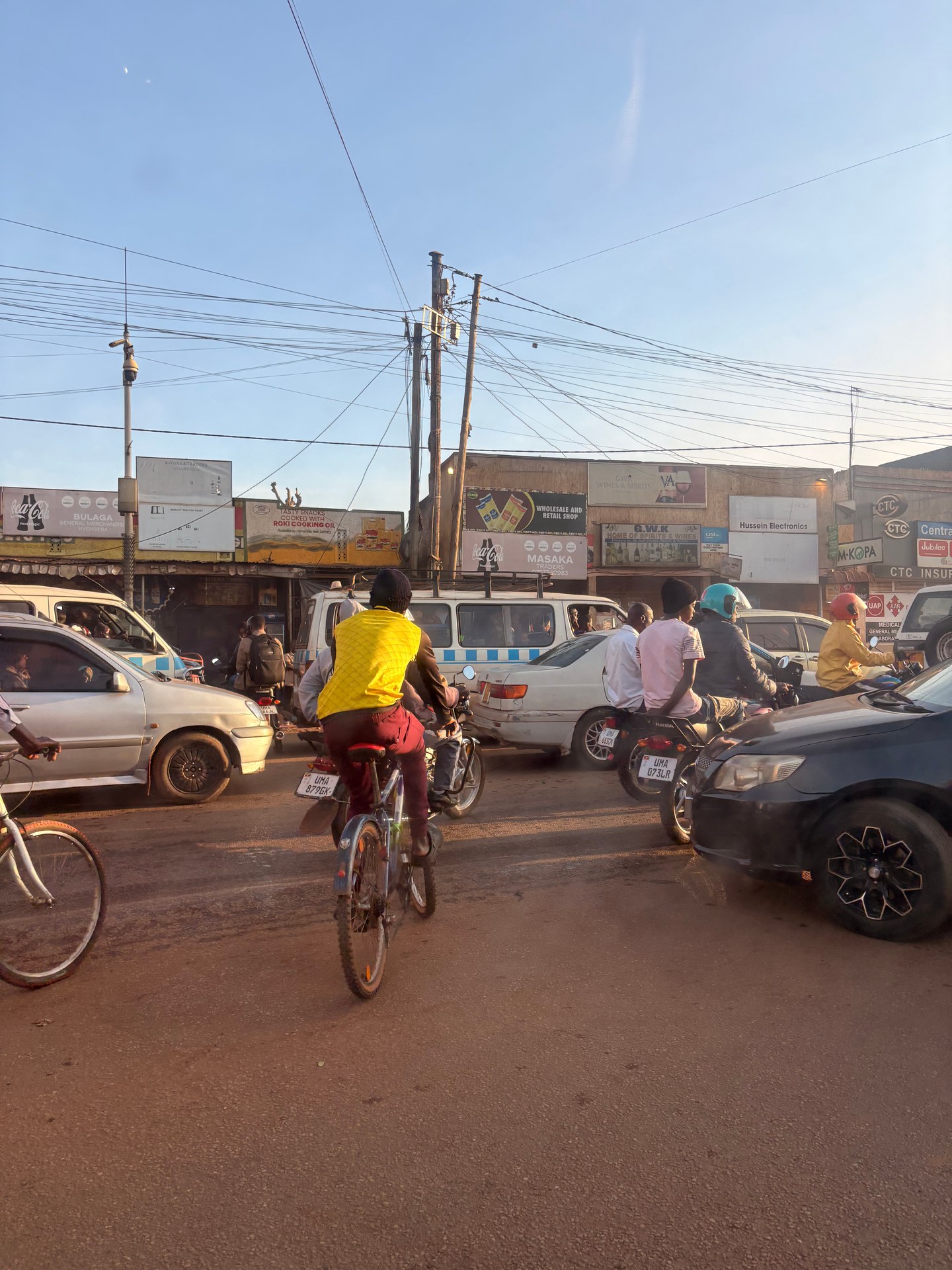
The term “boda-boda” comes from the Kenya-Uganda border crossings, where motorcycle riders would ferry people from one side to the other — “border to border,” compressed into the colloquial shorthand used today. In Kampala, boda-bodas are not merely transport; they are the circulatory system of the city. They carry office workers to their jobs, deliver hot food from roadside kitchens, shuttle children to school, and haul construction materials to building sites. On a rural road outside Kampala in October 2024, I watched from the car as a boda-boda rider balanced several large water jerry cans on his motorcycle — no helmet, sandals on his feet, navigating a potholed road with the casual ease of someone who has done this a thousand times. For a European observer, it was a startling image. For Uganda, it was Tuesday.
The Kampala Capital City Authority (KCCA) — the administrative body responsible for the city — has acknowledged the scale of the challenge. According to the KCCA’s Multi-Hazard Risk and Vulnerability Profile published in August 2018, the capital was experiencing urbanisation growth of 5.6 per cent per year, driven primarily by rural-to-urban migration. The Kampala metropolitan area, which extends into the neighbouring districts of Wakiso and Mukono, concentrates more than 32 per cent of Uganda’s manufacturing activity. That economic gravity pulls people, vehicles, and goods into a road network that was never designed for this volume of traffic.
For safari travellers, the practical implication is straightforward: do not underestimate how long it takes to get through Kampala. If your lodge is in Murchison Falls, Kibale, or Bwindi, you will spend between one and two hours just clearing the city limits. Most experienced tour operators — including outfits like Nturo Safaris and Deks Safaris — schedule departures before dawn specifically to beat the worst of the morning traffic. If your flight lands in the afternoon, most operators will arrange one night in Entebbe or Kampala before starting the drive to the national parks the next morning.
[QUOTE: local guide on first impressions of Kampala traffic]Uganda’s Road Network — Infrastructure, Investment, and What Travellers See
Uganda’s road network is in a state of active transformation. The country is investing heavily in trunk road rehabilitation, and the scale of that investment is visible to anyone who drives between the capital and the safari regions. The flagship programme is the Kampala City Roads Rehabilitation Project (Project 1658), managed by the KCCA, with approved total budget costs in the financial year 2024/25 reaching approximately 469 billion Uganda shillings (according to Uganda’s Ministerial Policy Statements for 2024/25). This is a substantial allocation by Ugandan standards, reflecting the government’s recognition that Kampala’s road infrastructure is a bottleneck for the entire national economy.
The investment is not limited to Kampala itself. The Japan International Cooperation Agency (JICA) co-finances machinery and equipment maintenance for road rehabilitation outside the city. The 2nd Kampala Institutional and Infrastructure Development Project (Project 1295) had budget estimates of over 9.4 billion Uganda shillings for urban road network development in the preceding financial year (source: MPS 2024/25). Meanwhile, the KCCA allocated approximately 17.4 billion Uganda shillings for environmental and natural resources management in 2024/25, part of which covers drainage and wetland restoration — both directly connected to road durability, since poor drainage is the primary cause of road deterioration in Kampala’s low-lying areas. Neighbourhoods like Bwaise III, situated in a natural drainage basin, experience routine flooding during the rainy seasons that degrades road surfaces within months of resurfacing.
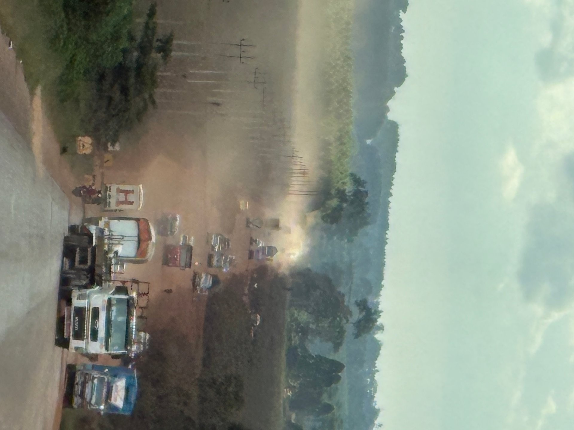
What does all this mean on the ground? In January 2026, I drove the Masaka Highway south-west from Kampala and witnessed the rehabilitation first-hand. Long stretches of the road had been stripped back to sand and laterite, with heavy machinery parked at intervals. Trucks, cars, and boda-bodas shared a single unpaved carriageway, kicking up clouds of red dust that reduced visibility to a few dozen metres. For the lorry drivers without air conditioning — which, in Uganda, is most of them — the conditions were punishing. The boda-boda riders had it worse, breathing unfiltered dust at road level while navigating between vehicles that outweighed them by several tonnes.
The Masaka Highway is one of Uganda’s most important transport corridors. It connects Kampala to the south-western regions that include Queen Elizabeth National Park, Bwindi Impenetrable Forest, Lake Bunyonyi, and the Rwandan border. Almost every overland safari to Uganda’s gorilla trekking destinations passes along some section of this route. When the rehabilitation is complete, the upgraded highway will significantly reduce travel times to the country’s premier wildlife areas. Until then, travellers should prepare for sections of rough, dusty road that slow progress and require patience.
The division-level budget allocations tell their own story. The Makindye Division Urban Council, one of Kampala’s five administrative divisions, received a budget allocation of approximately 526 million Uganda shillings under the Kampala City Roads Rehabilitation Project in the 2023/24 financial year (source: MPS 2024/25). Multiplied across all five divisions — Makindye, Nakawa, Kawempe, Lubaga, and the Central Division — the cumulative road spending is reshaping the city’s transport infrastructure, albeit slowly and unevenly. The Central Division, home to the main commercial areas including Owino Market and Nakawa Market, tends to receive priority attention. Outer divisions, where many of the city’s informal settlements lie, wait longer.
Routes to the Safari Lodges — What to Expect on the Road
Every safari in Uganda begins with a road journey, and the character of that journey varies dramatically depending on your destination. Having driven these routes repeatedly, I can describe exactly what each one looks like from the passenger seat.
Kampala to Murchison Falls via Luwero
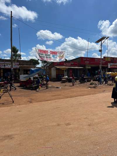
The northern route to Murchison Falls National Park passes through Luwero, a small trading town roughly 80 kilometres north of Kampala along the Kampala–Gulu highway. In October 2024, driving through Luwero on our way to Murchison Falls, we passed colourful roadside market stalls with red canvas awnings and hand-painted signage. The town has the feel of a waypoint — somewhere people pause, refuel, buy provisions, and move on. The atmosphere was warm and unhurried, a noticeable contrast to the frenzy of Kampala two hours behind us.
Beyond Luwero, the road continues through Nakasongola and then west toward Masindi, the gateway town to Murchison Falls. This stretch is generally well-surfaced, though potholes appear without warning after heavy rains. The total journey from Kampala to Murchison Falls covers roughly 305 kilometres and takes between five and six hours under normal conditions. Safari operators typically schedule an early departure from Kampala and arrive at the park gate by early afternoon, allowing time for an afternoon game drive or boat safari on the Victoria Nile. Lodges in the Murchison Falls area range from the established luxury properties along the Nile to mid-range and budget camps closer to the Paraa ferry crossing.
On this same route, somewhere between Luwero and Masindi, I encountered one of the most distinctively Ugandan sights of my travels: a standard passenger minibus rolling along the tarmac with a stack of mattresses on its roof that rose to roughly double the vehicle’s height. The load was strapped down with ropes and appeared to defy basic physics. It was, by European standards, dangerous and absurd. By Ugandan standards, it was a delivery vehicle doing its job. These overloaded transports are a daily reality on the trunk roads — a product of limited freight infrastructure and entrepreneurial pragmatism. They are also a reminder that Uganda’s road system serves purposes far beyond tourism: it is the backbone of a domestic economy where goods move by road or they do not move at all.
Kampala to Bwindi via the Masaka Highway
The south-western route to Bwindi Impenetrable National Park — Uganda’s premier gorilla trekking destination — is longer and more demanding. The journey covers approximately 430 kilometres and takes between eight and ten hours, depending on road conditions and which sector of Bwindi you are heading to. The first section follows the Masaka Highway, which, as I described above, is under active rehabilitation. Tour operators like Nturo Safaris and Deks Safaris know the road intimately and adjust their routes and schedules according to which sections are currently passable and which are under construction.
Past Masaka, the landscape shifts from the flat, semi-urban sprawl of the Kampala periphery into the steep, terraced hills of south-western Uganda. The road narrows, the gradients increase, and the vegetation thickens to dense tropical forest. This is where the journey transitions from endurance test to scenery — the terraced hillsides, tea plantations, and cloud-forest ridgelines of the Bwindi region are among the most beautiful landscapes in East Africa. The final approach to lodges in the Buhoma sector, in particular, is a series of tight switchbacks through the forest canopy that makes the hours of highway driving feel worthwhile.
Boda-Bodas, Markets, and the Informal Economy of the Road
You cannot write about transport in Uganda without devoting serious attention to the boda-boda. These motorcycle taxis are everywhere — in Kampala, in the national park buffer zones, in villages with a single red-dirt road and three buildings. They are the last-mile solution for a country where public bus networks are limited and private car ownership remains a luxury. A boda-boda can navigate a muddy track that would strand a four-wheel drive. It can reach a health clinic in a rural parish where no paved road exists. It can deliver a sack of charcoal, a crate of soft drinks, or a passenger with a suitcase to a lodge gate.
The riders operate without formal employment contracts. Most rent their motorcycles from an owner and keep whatever they earn above the daily rental fee. Helmets are legally required but rarely worn outside Kampala’s central areas. Riding in sandals is standard practice. The risk is real — motorcycle accidents are a leading cause of injury in Uganda — but the economic logic is unanswerable: for many riders, the boda-boda is the only viable income source in a country where formal employment covers a fraction of the working-age population.
For visitors, boda-bodas are fascinating to watch and photographically irresistible. I have images of riders carrying improbable loads — stacks of water canisters, bundles of sugarcane, live chickens, lengths of timber that extend two metres behind the motorcycle. On a rural road near Luwero in October 2024, I photographed a boda-boda rider transporting four large water jerry cans strapped across his rear seat, riding without a helmet in sandals along a potholed road flanked by green vegetation. The image captured something essential about Uganda’s informal transport economy: resourceful, precarious, and utterly indispensable.
Roadside markets are the other constant companion of any Ugandan road journey. Every trading town — Luwero, Masindi, Hoima, Kabale, Kisoro — has its cluster of stalls selling produce, household goods, and cooked food. Some markets, like Owino Market in Kampala (established in 1971, specialising in second-hand clothing and practical goods) and the KCCA-registered Wandegeya Market in Kawempe Division with its 1,117 registered vendors, are permanent institutions. Others are informal arrangements that materialise wherever traffic slows — a junction, a speed bump, a construction zone. The Nakawa Market, also KCCA-registered, operates from permanent structures in the Nakawa Division and serves approximately 4,000 vendors. These markets are the retail backbone of a country where supermarkets remain concentrated in Kampala and a handful of secondary cities.
For safari travellers, the roadside markets are worth a deliberate stop. The produce is fresh, the prices are low, and the interaction with vendors is one of the most accessible ways to engage with daily Ugandan life outside the lodge compound. Ask your driver to pull over at one of the larger stalls — most are happy to explain what is being sold and at what price. Roasted maize, grilled plantain (gonja), and chapati are reliable, safe, and satisfying road food.
Practical Transport Advice for Safari Travellers
Use your operator’s driver. Uganda drives on the left, but road discipline is loose. Lane markings are absent on most rural roads. Overtaking happens on blind corners. Speed bumps are sometimes unmarked. The boda-boda traffic in Kampala alone is reason enough to leave the driving to a professional. Every reputable safari operator — whether it is a large outfit handling dozens of clients per month or a smaller company like Afoyo African Safaris — employs drivers who know the roads, the vehicles, and the conditions. Self-driving is possible but carries risks that most holiday travellers do not need to accept.
Plan for the dust. If your route includes any section under rehabilitation — and in 2026, this includes stretches of the Masaka Highway and several feeder roads to national parks — pack a lightweight scarf or buff to cover your nose and mouth. Close your vehicle windows during the dustiest sections, even if it means relying on air conditioning. Camera equipment is particularly vulnerable to fine laterite dust; keep lens caps on and store bags in sealed containers whenever possible. I learned this the hard way on the Masaka Highway in January 2026, where the dust was so thick it reduced visibility to a few car lengths ahead.
Carry water and snacks. Driving distances between towns can be substantial, and while roadside stalls are frequent, there are stretches — particularly between Masindi and Murchison Falls, and between Kabale and the Bwindi sectors — where options thin out. Two litres of bottled water per person and a bag of groundnuts or biscuits will keep you comfortable through an unexpected delay, a flat tyre, or a construction-zone slowdown.
Expect the unexpected. Road travel in Uganda operates on a different set of assumptions than what most Western travellers are accustomed to. You will share the road with overloaded minibuses, cattle being herded along the verge, and boda-boda riders carrying cargo that defies imagination. Road closures due to construction, flooding, or the occasional broken-down truck blocking both lanes are not rare events — they are routine features of the journey. The correct attitude is patience, not frustration. Your driver knows what to do. The road will clear. You will reach your lodge. The journey itself — with its markets, its landscapes, its improbable vehicles, and its cheerful chaos — is part of the Uganda experience.
Uganda’s environmental regulations add another layer of governance to road and construction projects. Statutory Instrument No. 47 of 2020 requires environmental impact assessments for major infrastructure works, including road construction. This means that rehabilitation projects, while slow, are subject to oversight that considers drainage, wetland encroachment, and ecological impact. The Lubigi wetland system near Kampala, for example, has been the focus of restoration projects aimed at preventing the wetland loss that accelerates flooding and road degradation. The National Environment Management Authority (NEMA), headquartered in Kampala, is the central regulatory body responsible for enforcing these requirements.
The broader context is that Uganda is a country of approximately 46 million people, and Kampala generates roughly 65 per cent of the national GDP. The capital’s five administrative divisions — Makindye, Nakawa, Kawempe, Lubaga, and the Central Division — each have their own urban council with budget allocations for roads, health, and environmental management. The KCCA Statistical Unit tracks and publishes data on infrastructure spending, market registration, and urban development. For a country with Uganda’s income level, the institutional framework for managing its capital city is remarkably structured — the challenge is one of resources and pace, not of intent.