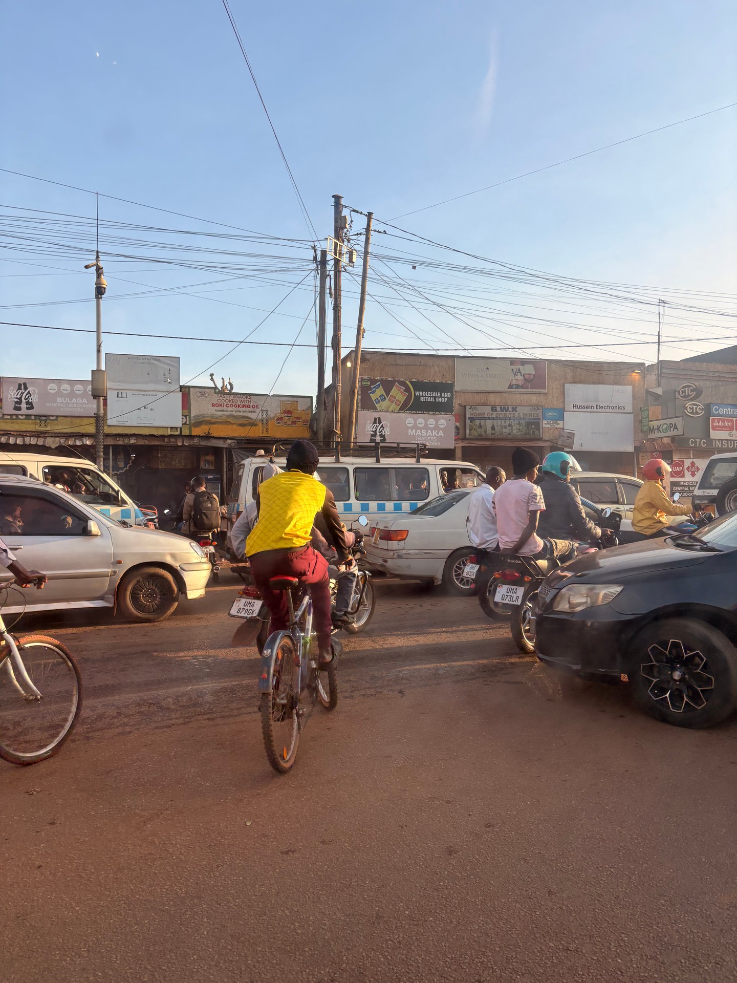
After being collected at Entebbe Airport in January 2026, we drove directly through Kampala. The capital was exactly as dense and kinetic as it sounds: vehicles of every description crossing the road in patterns that appeared chaotic but were, on closer observation, governed by an informal logic of eye contact and momentum. At the roadside, small stalls and shops pressed up against the tarmac — fruit vendors, mobile phone repair kiosks, welding workshops, and charcoal sellers, all operating within arm’s reach of passing traffic. The noise was substantial. The energy was constant. And the first impression for a visitor arriving from Europe, as we were, was that Kampala operates at a speed and density that no amount of reading prepares you for.
We have driven through Kampala on seven separate occasions between October 2024 and May 2026 — arriving from Entebbe Airport, passing through en route to Murchison Falls or Bwindi, and returning through the city at the end of safari trips. Across those visits, with six GPS-tagged photographs documenting locations from 0.2833°N, 32.4561°E in central Kampala to 0.1065°N, 32.1723°E on the Masaka Highway, the pattern that emerged was one of a city undergoing substantial infrastructure transformation while simultaneously managing the daily reality of being East Africa’s most congested urban centre. The roads are being rebuilt. They are also, on any given day, full of traffic that makes the rebuilding both necessary and difficult to complete.
For safari travellers, Kampala is typically a transit point — you land at Entebbe, drive through the capital, and continue to your first national park or lodge. Understanding what to expect from the roads, the transport culture, and the available health services is practical rather than academic. This guide covers what we observed first-hand across multiple transits, supplemented by data from official sources including the KCCA Strategic Plan 2025 and the Ministerial Policy Statement 2024–25.
The Kampala City Roads Rehabilitation Project — $288 Million of Transformation
The Kampala Capital City Authority (KCCA) is the governance body responsible for the city’s roads, drainage, lighting, and urban planning. The scale of the infrastructure challenge is reflected in the numbers. The Kampala City Roads Rehabilitation Project (KCRRP) cost $288 million and was funded jointly by the African Development Bank, the Global Environment Facility, and the Government of Uganda, according to the KCCA Strategic Plan 2025. The project targeted the city’s most deteriorated road surfaces — arteries that carry the combined weight of commercial lorries, public minibus taxis, private vehicles, boda-boda motorcycles, bicycles, and pedestrians, often simultaneously and on surfaces designed for a fraction of that load.
Alongside the KCRRP, the Kampala City Roads and Bridges Upgrading Project (KCRBUP) will construct 109 kilometres of new roads across the city, according to the KCCA Strategic Plan 2025. The Kampala City Drainage Improvement Project (KCDIP), with estimated costs of UGX 447.61 billion, addresses the flooding that compounds road deterioration — Kampala’s hilly terrain and intense rainy seasons mean that water damage is a constant threat to road surfaces. The Kampala City Lighting and Infrastructure Improvement Project (KCLIIP) will install 20,801 street lights, improving safety on roads that are, at present, poorly lit after dark. Taken together, these projects represent a systematic attempt to bring Kampala’s road infrastructure to a standard that can support a metropolitan area covering Kampala, Wakiso, and Mukono — a region that concentrates over 32 per cent of Uganda’s manufacturing activity.
The Japan International Cooperation Agency (JICA) is working with KCCA on the improvement of 20 intersections — critical bottleneck points where traffic congestion is most acute. For visitors driving through the city, these intersections are where the infrastructure gap is most visible: vehicles queuing in three or four informal lanes on a road designed for two, with boda-bodas threading through gaps that would give a European driver vertigo.
The Masaka Highway — Dust, Construction, and the Route to Bwindi
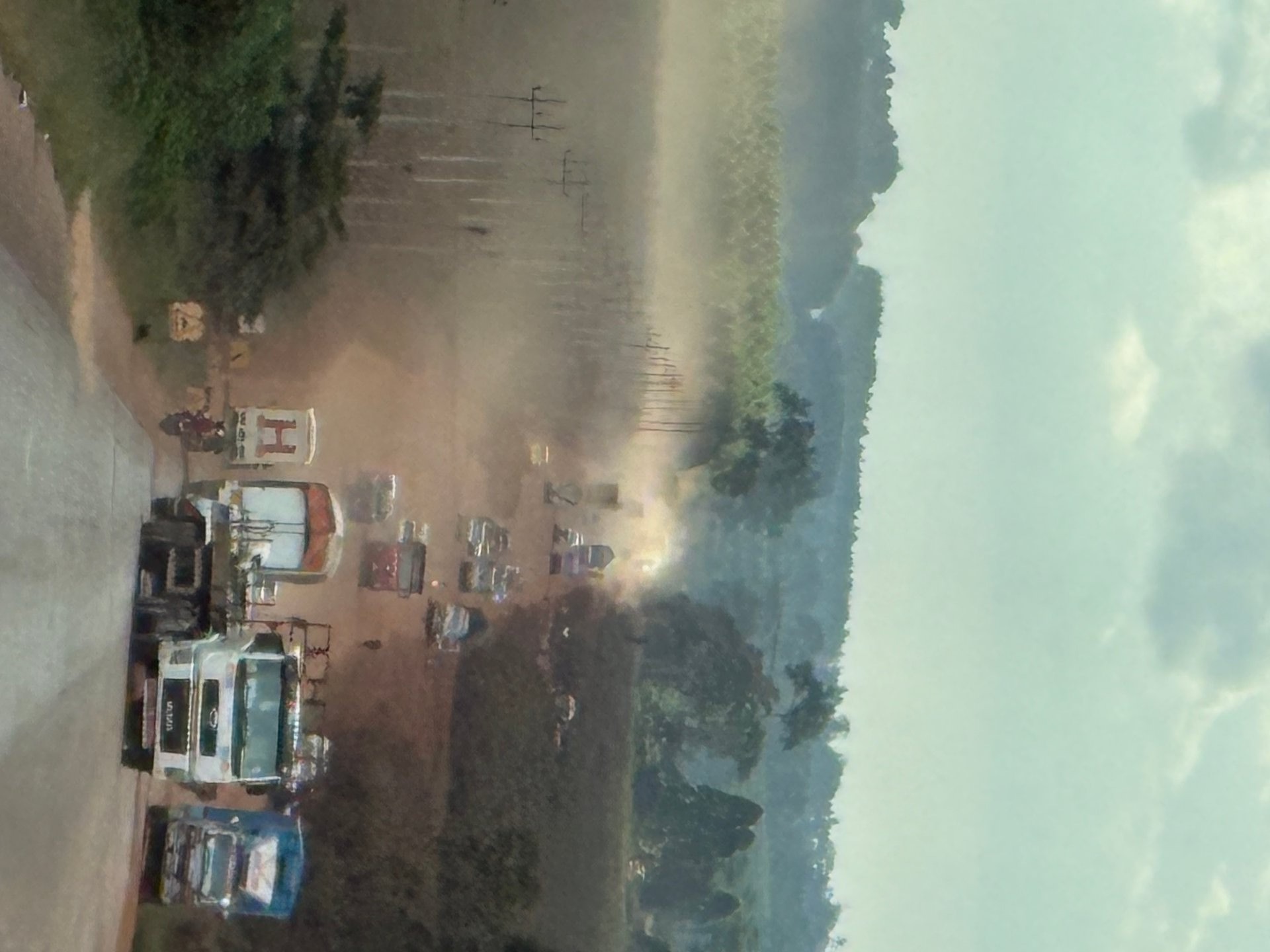
The Masaka Highway is one of Uganda’s principal transport corridors — the main route south and southwest from Kampala towards Masaka, Mbarara, and eventually the national parks of south-western Uganda including Bwindi Impenetrable National Park and Queen Elizabeth National Park. When we drove the highway in January 2026, it was under active rehabilitation. Sections of finished asphalt alternated with long stretches of unpaved construction zone — sand, dust, and gravel through which lorries, cars, jeeps, and boda-bodas all competed for road space.
The dust was the defining feature. On the unpaved sections, every passing vehicle raised a plume that hung in the still air and drifted across the road surface, reducing visibility and covering everything — vehicles, drivers, roadside stalls — in a fine red-brown film. For lorry and car drivers, this was uncomfortable. For boda-boda riders, exposed to the elements without any cabin protection, it was considerably worse. Many vehicles on the highway have no air conditioning — the combination of dust and heat at midday on the Masaka Highway is a physical endurance test that the infrastructure upgrade will eventually resolve but has not yet.
The highway’s significance for safari travellers is direct: if you are driving from Kampala to Bwindi (approximately 530 kilometres, seven to nine hours), the Masaka Highway is almost certainly part of your route. The road is passable but slow in construction zones, and journey times should be estimated generously. Safari operators familiar with the current road conditions will adjust their schedules accordingly — this is one of many reasons why using a local operator with current ground knowledge is preferable to self-driving.
[QUOTE: local driver or safari operator on current Masaka Highway conditions]
Boda-Bodas — Uganda’s Universal Transport Solution
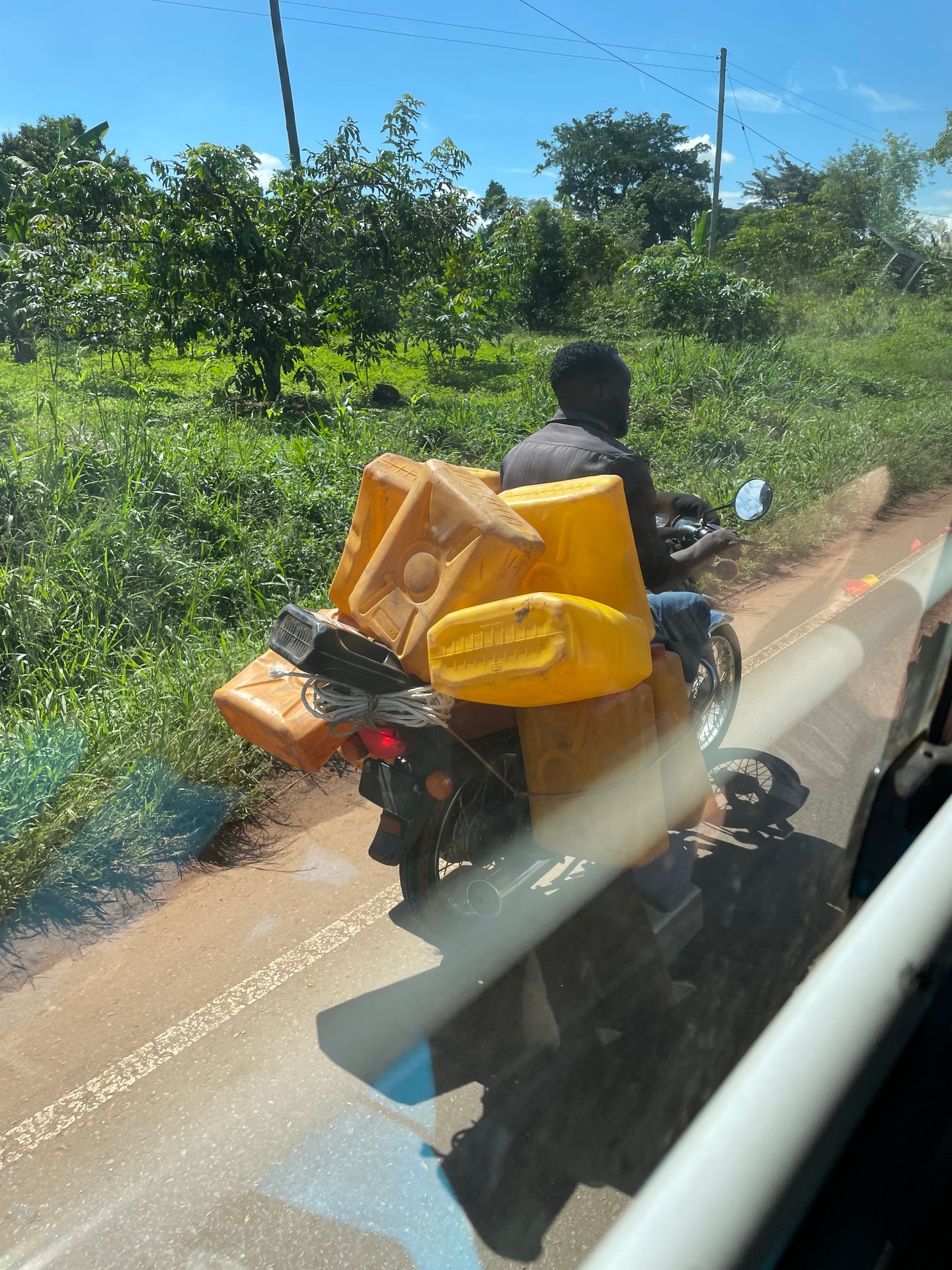
The boda-boda is not merely a vehicle in Uganda — it is an infrastructure layer. These motorcycle taxis carry passengers, water containers, agricultural produce, building materials, livestock, and combinations of cargo that would be prohibited in any jurisdiction with enforced vehicle loading regulations. On a rural road outside Kampala in October 2024, we photographed a boda-boda rider transporting several large water jerry cans strapped to his motorcycle — riding without a helmet, in sandals, on a road shared with lorries and cars. The image is extraordinary by European standards. By Ugandan standards, it is entirely unremarkable. This is how water reaches homes in areas without piped supply. This is how goods move in communities without delivery services. The boda-boda fills every logistical gap that formal transport infrastructure leaves open.
In Kampala itself, boda-bodas dominate the streetscape. During our May 2026 transit through the city, the most striking visual was not the cars or the minibus taxis but the sheer density of motorcycles — gathered at every junction, weaving through traffic in groups, and parked in clusters at informal staging points where riders wait for passengers. The KCCA has established a Public Transport Management Committee of 12 members that meets at least quarterly, according to the KCCA Service Standards 2025, to manage the interactions between boda-bodas, public minibuses, and other road users. The challenge is one of scale: the number of boda-bodas in Kampala is estimated in the hundreds of thousands, and enforcement of regulations — helmets, passenger limits, licensing — is inconsistent across the city’s five divisions.
For safari travellers, boda-bodas are a practical short-distance option in towns near national parks — useful for reaching a market or restaurant a few kilometres from your lodge. They are not suitable for long-distance travel, for reaching remote lodges on unpaved roads, or for travellers with significant luggage. If you use a boda-boda, negotiate the fare before departure, hold on firmly, and accept that the experience will be more visceral than anything a transfer vehicle provides.
Health Services in Kampala — What Travellers Should Know
Kampala’s health infrastructure operates across two parallel systems: public facilities managed by KCCA and private hospitals and clinics. The KCCA runs six public Health Centres distributed across the city’s five urban divisions — Central, Kawempe, Makindye, Nakawa, and Lubaga. These facilities provide primary healthcare including outpatient consultations, maternal and child health services, immunisation, and basic emergency care. The KCCA conducts citizen satisfaction surveys at these centres as part of its service quality monitoring, according to the KCCA Strategic Plan 2025.
For travellers, the private healthcare sector is more relevant. Private hospitals in central Kampala offer a higher standard of facilities, shorter wait times, and English-speaking medical staff experienced with international patients. International SOS and several private clinics operate 24-hour emergency services. Travel insurance that covers medical evacuation is essential — specialist care for serious conditions may require transfer to Nairobi (Kenya) or Johannesburg (South Africa), as Kampala’s specialist capacity, while growing, does not yet cover all medical disciplines at international standards.
Pharmacies are widely available in central Kampala and in the larger towns along safari routes. Basic medications — antimalarials, antibiotics, rehydration salts, pain relief — can be purchased over the counter. Travellers should carry a personal medical kit for use in national park areas where pharmacies may be several hours away by road. The KCCA has invested in health infrastructure improvements: 22 public schools in Kampala received support for the construction and renovation of water, sanitation, and hygiene (WASH) facilities in partnership with the LV WATSAN project, according to the MPS 2024–25 — an investment that reflects the broader public health focus on water quality and sanitation across the city.
The environmental context is also relevant to traveller health. For the 2024/25 fiscal year, KCCA allocated UGX 17.45 billion to the environmental and natural resource management subprogramme, according to the MPS 2024–25. Air quality in Kampala — affected by vehicle emissions, dust from construction, and charcoal burning — was the subject of a joint investigation with GIZ in 2012 and remains an area of ongoing monitoring. Kampala’s Climate Change Strategy sets a target of reducing greenhouse gas emissions from the transport sector by 20 per cent by 2030, according to the KCCA Strategic Plan 2025. For travellers, particularly those with respiratory conditions, the air quality in central Kampala during rush hour is noticeably worse than in the national park areas where lodges are located.
National Park Access Roads — Murchison Falls and Beyond
The contrast between Kampala’s congested streets and the access roads to Uganda’s national parks is stark. When we reached the entrance to Murchison Falls National Park in October 2024, the road surface changed dramatically — a freshly asphalted, well-marked highway with white lane markings and a modern visitor centre visible ahead. The infrastructure at the park entrance was new, well-maintained, and built to a standard that would not be out of place in a European national park. It was, after hours of driving through construction zones and dusty highways, a visible statement of where Uganda’s infrastructure investment is being directed: towards the tourism assets that generate foreign exchange revenue.
This investment pattern — good infrastructure at park gates, variable quality on the roads that connect them — is characteristic of Uganda’s current development stage. The Greater Kampala Metropolitan Area Urban Development Programme, funded by the Government of Uganda and the World Bank, addresses strategic roads, public transport, and environmental management across the broader metropolitan region, according to the Kampala Speed Management Plan. The Kampala Transport Infrastructure Retooling Project, running from 2025/26 to 2029/30 with a budget of UGX 63.37 billion, according to the KCCA Strategic Plan 2025, will further improve the road network. KCCA plans to acquire and develop two bus terminals and truck parking areas along major traffic routes — improvements that will benefit both urban commuters and long-distance travellers heading to national parks.
For safari travellers, the practical takeaway is that road quality varies significantly within a single journey. You may drive on excellent asphalt within Kampala’s recently rehabilitated sections, transition to dusty construction zones on the Masaka Highway, return to good tarmac on a section completed last year, and then navigate unpaved tracks as you approach a remote lodge. Journey times are estimates, not guarantees. A seven-hour drive can become nine hours if a construction zone is congested or if rain has made a section of unpaved road slippery. Build in buffer time, leave early, and trust your driver’s local knowledge over any GPS estimate.